
A description of the main hiking tracks with walking hours and detail maps. For GPS users there are waypoint to download.
Description of the of the location of Cajas National Park. A simple google maps mash up with the Cuenca Guayaquil road, the city of Cuenca and the ranger station depicted

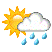
Weather, climate and useful tips for your stay in Cajas. Precipitation, solar radiation, humidity, temperature and atmospheric pressure are addressed.
General description of Cajas in terms of Geology, Plants, Animals and Soil

Information on Cajas parque nacional. All kind of questions and answers ..
Photos, pictures, imagenes

References, people, software and thanks
and contact information
The information on this web site has been carefully checked and to the best of our knowledge is accurate. However, details are subject to change and the owner of parque-nacional-cajas.org cannot be responsible for such changes, or for errors or omission. We cannot be responsible for any consequences, damages, losses or personal injury arising from the use of the maps, data or information on the parque-nacional-cajas.org web site.